| 23rd November 2003 |
 |
 |
 |
| Written by Mike Manning |
| Sunday, 29 March 2009 20:07 |
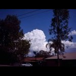
Storm Chase 23rd November, 2003Today started off very similar to the day before with hot and humid conditions. Wind shear was excellent with 50-55 knotts from the north-west @ 500, 60-70 knotts from the north-west @ 400 and 80 knotts from the north-west @ 300. Temps were 14 @ 850, 4 @ 700, -8 to -10 @ 500 and -34 to -36 @ 300. The atmosphere had dried out considerably in the last 12 hours which would help activity later on. Activity started off very early in the day with thunderstorms first developing around the Kilcoy area moving south-east at 50-60km/hr. More thunderstorms started forming on the border ranges and one just north of Brisbane. The storm north of Brisbane was very dark and had a thick anvil spreading out very quickly overhead. Unfortunately, it weakened quickly from my area and then reintensified near the coast. Rock solid updrafts were present for most of the day however, they couldn't get much higher than about 7000 feet. A few cells managed to break past this level for a while but didn't last for long. As the afternoon wore on, the trough moved north-east into the wide-bay/burnett districts to cause a few hours of severe thunderstorm warnings. South East Queensland by this stage was mainly cloud free except to the far north at the Sunshine Coast where a small cell developed. Overall it wasn't too bad a day. Later, I was treated to a spectacular Queensland sunset.
|
| Last Updated on Sunday, 29 March 2009 22:18 |


