| 5th September 2004 |
 |
 |
 |
| Written by Mike Manning |
| Sunday, 29 March 2009 20:07 |
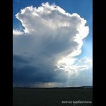
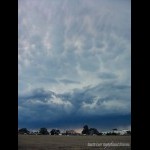
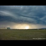
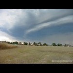
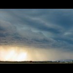
Storm Chase 5th September, 2004After Saturdays storms, the atmosphere had not stabilised at all and the upper trough was closer to the coast. As well as this, there was more moisture to play with and the mid level temps had dropped a few degrees. It was looking like another similar day to the day before with possible hail expected. The skies were completely clear in the morning and the temperature was quite mild still from the previous days storms. The sounding revealed a small cap which would help stop the convection until the afternoon. Just after mid day big TCu started to develop and one particular one took my interest just to the west of me producing some nice pileus. Within 15 minutes, this had become a weak storm and on radar it didnt look like too much. It weakened quite quickly however just after 1 as it was approaching Amberley, it exploded and I headed towards my favourite vantage point at Archerfield Airport which just happened to be the perfect position. I arrived there, set up my tripod and the northern flank of the storm was beginning to really take off with some nice solid updrafts happening. Tops at this stage would have been about 20000 feet at most. It didnt take long for a massive anvil to form on this and mammantus quickly became visible under the anvil during the early stages of the storm. A nice rfb was beginning to develop to the NW of the storm and to the SW of it some nice cgs were coming out ahead of the rain shafts. A massive rfb soon was the main feature on this storm and a gust front started to develop when it was about 10km west of Archerfield. The storm at this stage was showing maximum reflectivity on radar which probably indicated hail. I received a call from Anthony Cornelius who just happened to be a 5 minute drive from me and he met up with me at the Airport. The storm by this stage was at its most intense with an awesome gust front feature on it and a rippled rfb to the NW of the storm. This quickly decayed and the main core headed directly north of me so I missed out on getting any hail. There were some very close lightning strikes on the way back home though. This was one of the most photogenic storms that I had photographed for a while. Archerfield only picked up 3mm however every mm is a welcome relief from the dry conditions experienced in SE QLD. More pictures can be found here.
|
| Last Updated on Monday, 30 March 2009 21:41 |
