| 19th October 2004 |
 |
 |
 |
| Written by Mike Manning |
| Sunday, 29 March 2009 20:07 |
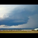
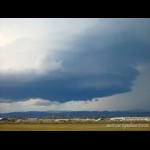
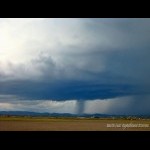
Storm Chase 19th October, 2004After yesterdays chase, things were looking nicely setup here in Se Qld with the trough pushing towards the coast and the dryline sitting just east of the ranges. Thunderstorm activity started off early in the morning around the Wide Bay area and slowly spread south. There was a lot of high level cloud around from the anvils of these massive storms and the radar was showing a nice red core moving towards Brisbane. I headed to my favorite viewing location at Archerfield Airport and setup the tripod. Within 30 minutes of me setting up, a meso started to develop. The meso became clearer by the minute and soon it had awesome stritations on it. The meso lasted only about 10 minutes however it produced quite a spectacular small but intense rainshaft under it when it was weakening.
More pictures can be found here.
|
| Last Updated on Monday, 30 March 2009 22:48 |


